Mount Sabyinyo is an extinct volcano with 5 peaks that give it its name: The Old Man’s Teeth. Getting to any one of them is a commendable achievement.
Mount Sabyinyo is the oldest volcano in the Virunga Mountains, a mountain range in the Albertine Rift Mountains. The summit of Sabyinyo, at 3,669 metres (12,037 ft), marks the intersection of the borders of the Democratic Republic of the Congo (DRC), Rwanda, and Uganda, and holds religious significance to local tribes. The slopes of Sabyinyo are a habitat for the critically endangered mountain gorilla, as well as mountain elephants and buffalo.
Description
Climb steep ridgelines, with and without wooden ladders, to reach three of Sabyinyo’s peaks. On the trail, you will pass through bamboo forests (home to mountain gorillas), Hagenia Hypericum forest and trees covered in Old Man’s Beard moss, before reaching the sub-Alpine zone.
Trip Highlights
- Climb wooden stairs and ladders
- Spectacular ridges
- Tri-border peak shared by Uganda, Rwanda and the Democratic Republic of Congo (DRC)
Wake up at the break of dawn (or before) and make your way to the Mgahinga Gorilla National Park. The UWA guides and guards that will accompany you on the trip recommend a start time from the park at 8 am. If you need a porter, you can organize this at the park entrance for a fee.
After a short security briefing, you will set off with an entourage of mandatory armed guards. The mountain is home to both elephants and buffalos, in addition to the gorillas, and warning shots are sometimes necessary if you are unlucky enough to meet an aggressive animal on the trail.
The first 45 minutes take you through bamboo forests where you might spot a gorilla if you’re lucky.
Once through the forest, the elevation picks up rapidly as you make your way up the winding trail surrounded by trees covered in shaggy Old Man’s Beard moss.
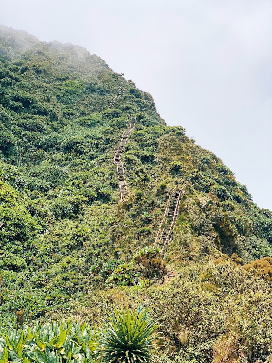
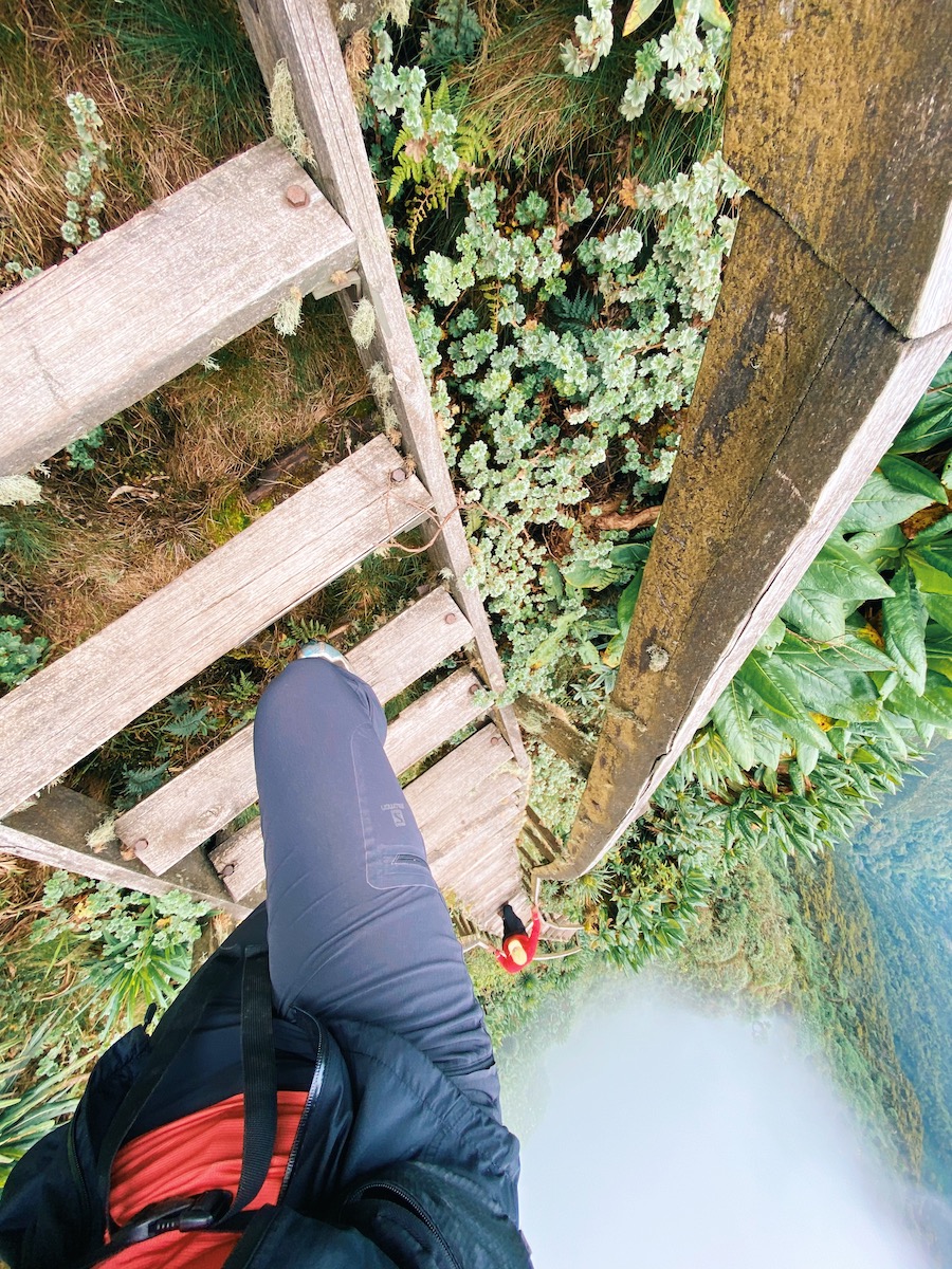
As you get closer to the first peak, you will encounter the stairs and ladders that give the trail the nickname “Stairways in the Mist”.
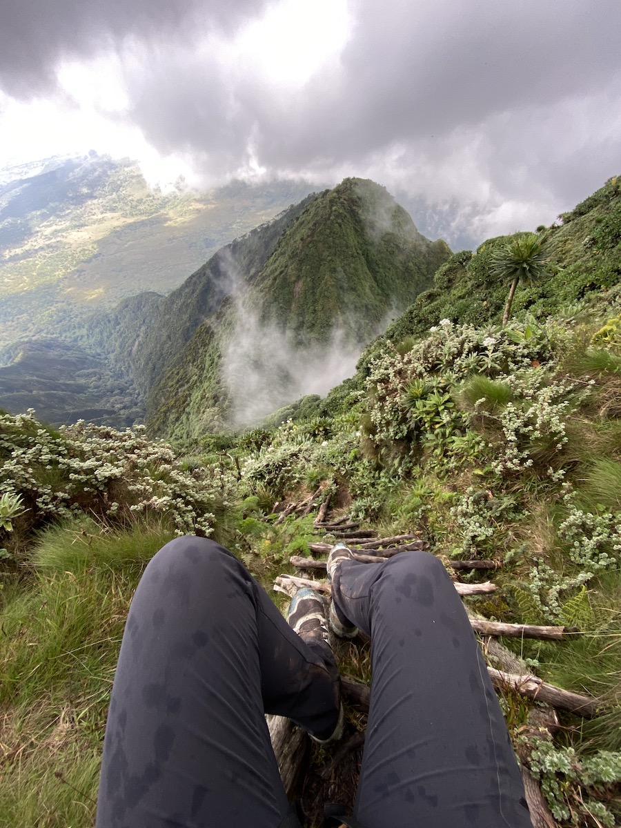
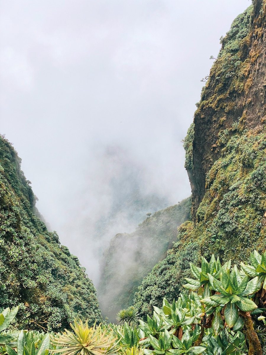
The first peak (3,423 m) offers a small hut to shelter from rain and/or wind. Grab a snack here before you follow the trail down and along a ridgeline that offers more stairs and ladders to help you stay stable. If you’re lucky with the weather, you will be treated to spectacular views of the drops.
Summit the second peak (3,537 m) and power on to the ultimate goal: The tri-border third peak (3,669 m) that is shared by Uganda, Rwanda and DRC.
Once there, whether in rain or shine, take your mandatory summit picks before turning back and returning the same way you came.
Key Details
Location
Kisoro, Uganda
Difficulty level
Intermediate
Trip length
6-9 hours
Distance
15 kilometres
Altitude gain
1360 meters
Season
Dry season
Dec – Feb, June – July
Need to know
Kisoro can be very cold. Furthermore, the Virungas are notorious for their rain – rainy season or not. Make sure to pack warm clothes, and rain jacket/pants/poncho.
We also recommend carrying gloves to keep warm, even if it’s raining, while climbing the ladders.
practical details
Where to stay
Amajambere Iwacu Community Camp
Next to the park entrance
Google maps
+256 774 954 956
There are also several hotels and lodges in Kisoro.
Tour company/contact person
You book your trip directly with the Uganda Wildlife Authority who will supply guides, guards and porters.


