The beautiful Mount Kadam is the second highest mountain of the Karamoja region with the highest peak at 3,063 meters.
Mount Kadam is a volcanic mountain that offers spectacular climbing opportunities and beautiful vistas. The mountain is a part of the Pian-upe Wildlife Reserve and is home to many tribes, including the Kadama, Sebei Pokot, Karamojong, Gishu and Tepeth. You are likely to meet many of them on the mountain, as the trails developed will pass by (or in some cases through) their settlements.
Description
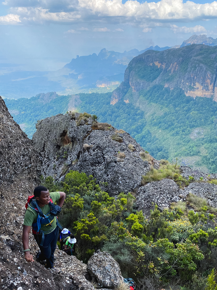
This 2-day hike is bushy and moderately difficult with some technical areas featuring steep slopes, rocks and squeaky bum time. The highest peak is 3,063m.
Trip Highlights
- 2-day trek to Mount Kadam (3,063 m)
- Spectacular mountain range
- Camp in the mountains
Day 1:
Drive from Kampala to Nakapiripirit District. We can recommend camping at Terrace Eco Tourism Gardens, a local ecotourism initiative formed by a team of unemployed youth, girls and women under Rural Action for Development Organization (RADO) in 2015.
Day 2:
Following a hearty breakfast, set off for the mountain. You can walk on a murram road to the trail head (3 km), or organise transportation. Once off the murram, you hike through lush green fields until you reach the foothills and the forest of Kadam. The ascent is steep, following narrow but well-defined trails that pass through local settlements. The final ascent to the campground is steep and requires a little bit of climbing, but ropes or climbing gear is not necessary. Leave the heaviest part of your luggage (tent, etc.) and continue following the trail through the jungle.
At this point, the trail will flatten out for 6 kilometres, before you start on the second ascent to the top of Kadam (3,063 m). Those who like simple rock climbing will love this part, as you scramble up rocks with nice handholds. Again, no ropes or special gear required.
Follow the trail up the ridge through tall bushes to reach the flat summit. Take photos of the staggeringly beautiful mountains, before turning around and heading back down the same way you came up.
Camp overnight in the mountains, spend your night stargazing and wake up to one of the most spectacular views we have ever seen.
Day 3:
Return down to Nakapiripirit via the same trail you used up. It’s quite a steep descent, so be careful not to trip and fall with your heavy backpack. Take a refreshing dip in the stream next to the Terrace Eco-Tourism Gardens.
Day 4:
Return home.
Key Details
Location
Karamoja, Uganda
Difficulty level
Intermediate
Trip length
2 days (you can also make it longer depending on the trip you choose)
Distance
25 kilometres
Altitude gain
1,800 meters
Season
Dry season
Need to know
Kadam is less developed than other hiking areas. When camping in the mountain you will have to carry everything you need (drinking and washing water inclusive). We also recommend self-catering (carry and cook your own food).
What it does offer are some of the best sunsets and views of the stars that you are likely to ever experience!
Please make sure to follow the mantra: Take nothing but photos, leave nothing but footprints!
Wondering what to pack? Here’s a detailed packing list.
practical details
Where to stay
Terrace Eco-Tourism Gardens
Google maps
+256 (0) 773 040 006
Hill View Resort
Google maps
Call on 0776589937 or 0751589937
Tour companies/local contacts
Max Chodery
Terrace Eco Tourism Gardens
+256 (0) 773 040 006
Kara-Tunga Adventures
+256 (0) 781 079 049


