Challenge yourself with a vertical kilometre of hiking.
Muhabura, or “the guide” in Rufumbira/Kinyarwanda, is the tallest mountain in the Virunga ranges of Uganda, and the third tallest in the total of the Virunga ranges. It straddles the Ugandan/Rwandan border. Standing at 4,127 metres ASL, this beast is certainly a challenge, with a vertical kilometre of hiking!
The “guide” of the peak of Muhabura can be seen for miles around, acting as a signal point for travellers in Rwanda and Uganda alike. Muhabura is an extinct stratovolcano.
Description
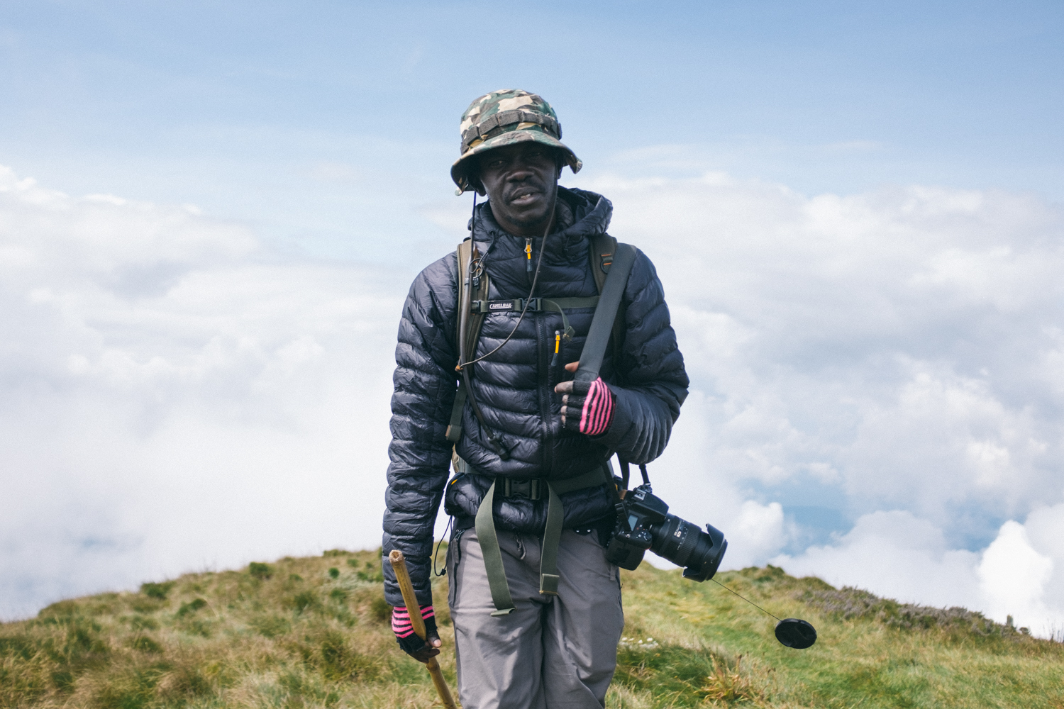
Hike uphill on a well-maintained trail from the gate of Mgahinga National Park all the way to the summit of Mt Muhabura. You will be accompanied by a guide and armed ranger (to keep you safe from the animals in the park, and them safe from you). On the trail, you will pass beautiful Lobelia and Alchemilla.
Trip Highlights
- Hike to 4,172 m in one day
- Spectacular views of the Virungas
- Crater lake at the top
Photos: Maren Hald Bjørgum
Park near the Ntebeko Visitor’s Centre – there is also a small bar to purchase drinks for the hike – and walk two hundred metres to register, pay and have a briefing from the rangers and guides. It is recommended you start the hike by 7 or 7:30 a.m. to have ample time to summit and descend the mountain.
The first stop is at about 3,117 meters above sea level while the second is at about 3,860 meters above sea level. You will pass through montane forest and slowly transition to a rocky slope of volcanic rock up towards lobelias, groundels and hypericum flowers at higher altitudes. If you are lucky to not be besieged by fog on your upwards descent, you will have clear views of Kisoro town, Lake Bunyonyi, and even the other Virungas stretching into Rwanda and Congo.
You will follow newly constructed (as of 2020) wooden stairs winding their way up the mountain, creating a pathway through giant lobelia and trees dripping with Spanish moss.
Make sure to take your time and drink plenty of water. Muhabura is a steep, conical volcano that continues steeply upwards until you reach the summit. Once you reach the second rest point, you will see a vertical cliff. Not to be intimidated, the trail takes you around to a grassy ridge straight to the summit.
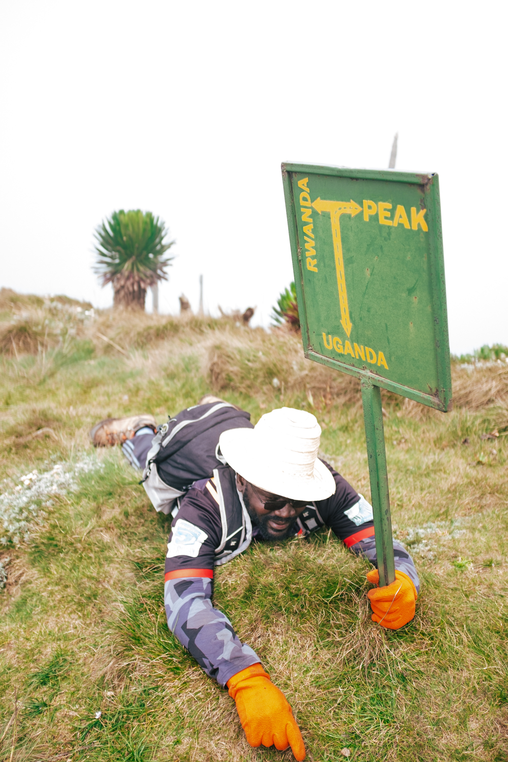
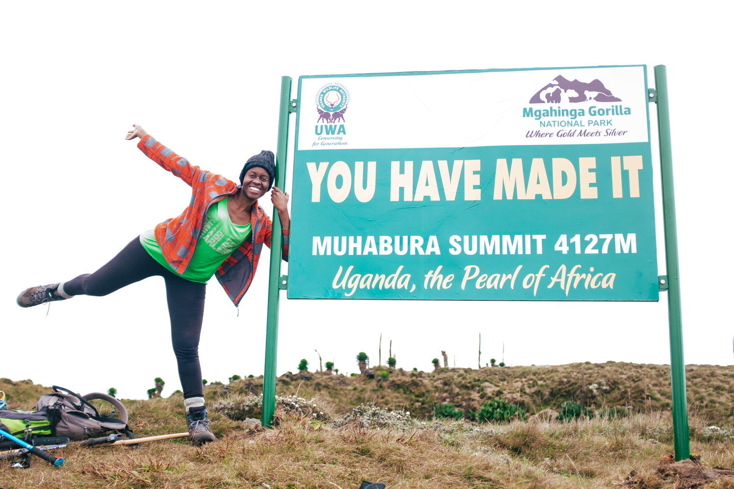
The summit, on clear days, offers spectacular views into Rwanda and Uganda, and features a crystalline crater lake forty metres across on top. Make sure to take photos with the sign! On clear days you can view the summits of Gahinga and Sabyinyo from the higher parts of Muhabura.
Descend back down to the starting point using the same trail, ensuring you do not slip down the stairs or ladders.
Key Details
Location
Kisoro, Uganda
Difficulty level
Intermediate
Trip length
6-8 hours, depending on fitness
Distance
9 kilometres
Altitude gain
1,921 meters
Season
Year-round
Best times are January, July – August
Need to know
Please be aware that if you are not at the second camp by 2 pm, you will be asked to turn around for safety reasons by the rangers.
Muhabura is a challenging hike and results in a significant altitude gain in a matter of hours. Symptoms of altitude sickness should be taken seriously and mitigated by drinking water, taking medication or descending the mountain.
UWA recently installed a hut close to the summit, which means you can now break the strenuous hike up into two days!
Pack plenty of layers. You may sweat profusely as you start the steep climb, but altitude gain means a steady temperature drop, when paired with unpredictable rainfall can make you cold quickly.
practical details
Where to stay
There are many places to stay in Kisoro town, but we would advise staying close to the park entrance to ensure you start hiking early enough.
UWA at Mgahinga National Park:
Plot 13, Bunagana Road,
P.O.Box 124, Kisoro, Uganda.
Tel: +256 414 680793/+256 392 881348
Costs for hiking currently are:
- Foreign tourists: $80 USD per person
- Foreign residents: $70 USD per person
- Ugandan nationals: 50,000 UGX per person
This excludes tips and the cost of a porter, should you wish, cost at 40,000 UGX for the day.


